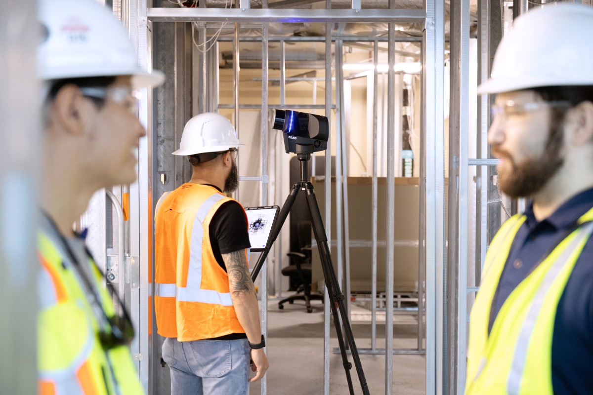
FARO® GeoSLAM
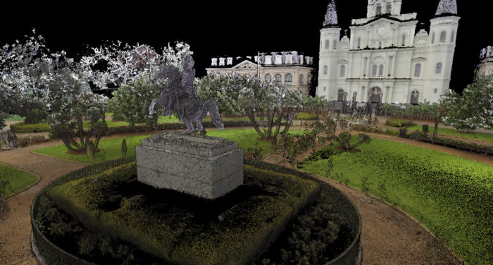
As the market leader in SLAM technology, GeoSLAM handheld LiDAR scanners make capturing geospatial data from the world around us easy. With long-range, high accuracy go-anywhere mapping, GeoSLAM technology is adaptable to all industries allowing you to scan, visualize and process data simultaneously. As a result, GeoSLAM improves your company’s efficiency, saves money, creates unbiased progress reports, and provides valuable data to help resolve any disputes.
![]()
Showing all 12 results
-
FARO® CONNECT Software
Read More -
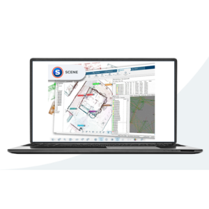
FARO® SCENE Software
Read More -
ZEB HORIZON RT with Connect + 1Y Wty
Read More -

FARO Connect – Perpetual Software License
Read More -
GeoSLAM Draw – Start Desktop
Read More -
GeoSLAM Volumes
Read More -
ZEB Locate inc. FARO Connect with 1Y FARO Standard Care GS
Read More -
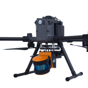
ZEB Horizon DJI M300 UAV Mount
Read More -
GeoSLAM ZEB Horizon Extension Pole
Read More -
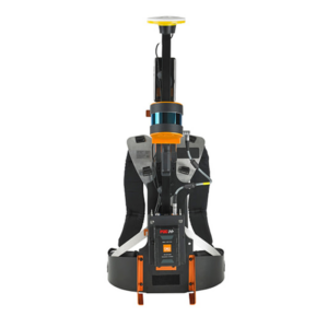
GeoSLAM ZEB Backpack Frame
Read More -
ZEB HORIZON Car Mount (requires V-mount) GS
Read More -
ZEB Cradle for Horizon inc. mounting plates
Read More
![]()
Fast and Effective Data Capture
- Capture and model data up to 10 times faster
- Complete projects in minimal time with little to no disruption to the project site
- Lightweight and compact design make ZEB-series scanners easy to use.
- Mobile mapping captures scans while on the move – whether handheld or mounted to vehicles, poles, or drones.
- Access challenging spaces without the need for GPS
- Build highly accurate 3D point clouds within minutes
- Automatic registration of multiple scans and geo-referencing using GeoSLAM Connect included with each system
- Import and manipulate data from any GeoSLAM device
- Track and record progress against a 3D model and generate clear progress reports with visualizations
- Quick and easy workflows with ‘drag and drop’ functionality
- Universal file formats (LAZ/LAS/PLY/TXT/e57)
- Optional Draw Packages: Start, Plan, BIM, Mining, and Pro can be purchased separately
ZEB Accessories:
- ZEB Vision for colorized point clouds
- ZEB Pano to add 360° panoramic photos to scans
- ZEB Pole for accessing ceiling voids
- ZEB Cradle to lower your device into shafts
- ZEB Guard for external protection in vertical shafts
- Car Mount
- UAV Mount
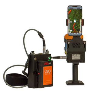
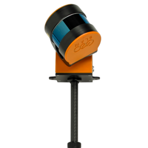
The GeoSLAM ZEB Horizon is the ultimate mobile mapping solution. Its lightweight and compact design make it perfect for indoor, outdoor or underground scanning.
- A range of 100m makes this the most flexible scanner
- Automatic data processing
- Single-operation automated workflows including scan alignment and georeferencing
- Survey grade relative accuracy up to 6mm when processing data in GeoSLAM Connect V2
- Can be mounted to a drone, backpack or vehicle.
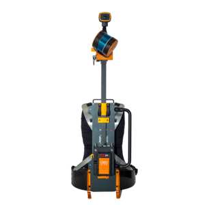
The GeoSLAM Horizon RT adds real-time data preview to the most versatile SLAM system available.
- Carry out high-quality scans in less time with 300,00 scanner points per second
- See the areas you covered or missed and the route you’ve taken before leaving site
The GeoSLAM ZEB Revo RT allows you to scan, process and track your progress as you go.
- View point cloud data in real-time
- Handheld, lightweight and easy to use
- Rapidly build highly accurate 3D models while on the move
- 43,000 scanner points per second
- 30 m range with a relative accuracy up to 6 mm
- Single-operation automated workflows including scan alignment and georeferencing
The GeoSLAM ZEB Go is the laser scanner for everyone. Small, easy and reliable the ZEB Go is the first step in SLAM handheld 3D laser scanning technology.
- User friendly and captures great quality data at high speed
- 43,000 points per second
- 30 m range with a relative accuracy of 1-3 cm
| Technical Specification | ZEB Go | ZEB Revo RT | ZEB Horizon |
|---|---|---|---|
| Range | 30m (features <15m) | 30m (features <15m) | 100m |
| Laser | Class 1 / ^905nm | Class 1 / ^905nm | Class 1 / ^903nm |
| FOV | 360 x 270 | 360 x 270 | 360 x 270 |
| Protection Class | IP64 | IP54 | IP54 |
| Processing | Post | Real Time | Post |
| Data Logger Carrier | Backpack | Shoulder Pack | Backpack or Shoulder Strap |
| Scanner Weight | 950g | 1.05kg | 1.45kg |
| Datalogger Weight (incl. battery) | 1.7kg | 1.4kg | 1.4kg |
| Colorized Point Cloud | Yes^ | Yes^ | Yes* |
| Intensity | X | X | Yes |
| Scanner Points Per Second | 43,000 | 43,000 | 300,000 |
| No. of Sensors | 1 | 1 | 16 |
| Relative Accuracy | 1-3cm^^ | Up to 6mm** | Up to 6mm** |
| Raw Data File Size | 100MB/min | 100MB/min | 100-200MB/min |
*with ZEB Vision **When processing data in GeoSLAM Connect V2
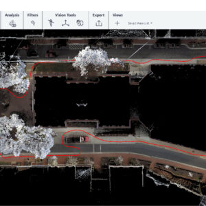
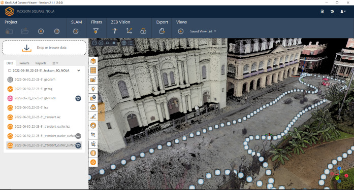
GeoSLAM Connect
GeoSLAM Connect is a powerful, flexible software platform used to configure, process, and manage data generated by ZEB-series handheld scanners. Connect uses GeoSLAM’s leading SLAM algorithm for visualization, processing, filtering, and workflow automation.
Combine with one of GeoSLAM’s Draw packages for quick extraction of 2D plans from 3D point cloud data, and GeoSLAM Connect offers a complete solution for all your data processing needs.
Automated Point Cloud Processing with Smart Analytics
- Automate your data processing with customizable workflow scripts
- Visualize data using the Connect 3D Application
- Point clouds can be colored by time, elevation, RGB, or custom single color
- Pointcloud filtering by point decimation or range
- Manage ever-increasing amounts of data and collect data as often as you need it
- Remote field-to-office data transfer
- Solve industry-specific problems
- Store data on a company network or in a project collaboration tool like Google Drive, Dalux, BIM360, or Viewpoint 4projects
- Smartphone imagery and notes app (Android) for additional data to help interpret point clouds
- Optional Draw Packages: Start, Plan, BIM, Mining, and Pro
The FARO Orbis is the newest ultimate mobile mapping solution fueled by innovation, and groundbreaking advancements that are set to reshape industries and redefine how businesses approach 3D data capture.
Simultaneous Localization and Mapping (SLAM) enabled technology has spent over a decade transitioning into the way we collect spatial data and understand the world around us from construction, to mining to facilities management and beyond. Now, FARO marks the latest evolution of mobile scanner with the release of FARO® Orbis™, powered by GeoSLAMs proprietary SLAM algorithm.
Powered by Flash Technology™, Orbis has the means to capture highly accurate data, at the speed of the users walk, as well as in-built stationary scanning capacity for mapping areas like complex pipework. The addition of higher accuracy from a mobile scanning solution makes it more justifiable than ever before to add to your surveying toolkit.