Real-Time Accuracy, Built Into Every Scan
What if your scans could place themselves—accurately and instantly?
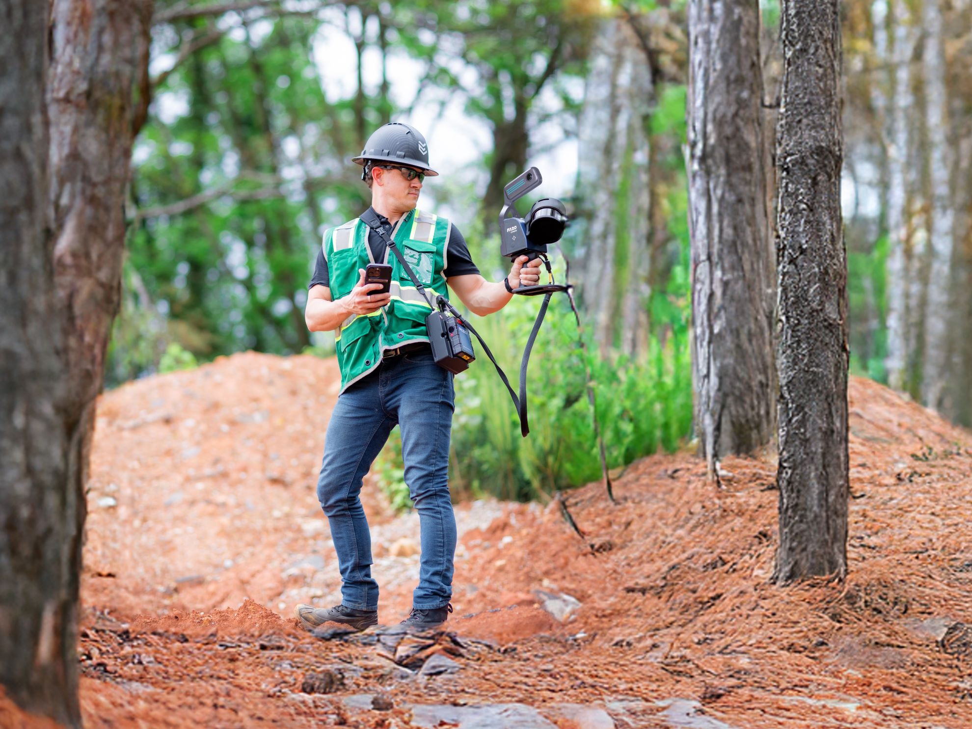
With Dot3D (6.0+) and Emlid Reach RX2, you can now capture scans that are automaticallyaligned to high-accuracy GNSS/RTK coordinates in real time.
No extra steps. No manual alignment.
As you scan, GNSS data is continuously integrated—giving you:
- Automatic positioning into global coordinate systems
- Improved local accuracy throughout the scan
- Smarter optimization based on signal quality
This is especially powerful for outdoor projects like highways intersections and utilities spaces where accuracy and efficiency matter most.
- Emlid Reach RX or RX2
- Dot3D Prime
- iPhone Pro / Pro Max
- Mounting kit + phone mount
The result? Faster workflows and more reliable data—right out of the field.
Integrated LiDAR scanning is currently exclusive to iOS (with Pro or Prime). External GNSS (RX, RX2, DA2) compatibility is currently exclusive to iOS (Prime only).
Let me know if you’d like to see how this works in action, or click HERE to try DOT3D for free.
Tags: Dot3DCategorized in: Articles
This post was written by Soniel San Pedro