Construction challenges create opportunities for GeoSLAM technologies
Historically the construction industry has faced challenges from early design phases through project completion. Many problems are traceable to incomplete and inaccurate information, which leads to increased construction costs, extended construction timelines, and inflated budgets.
Brownfield projects, upgrades to existing industrial or manufacturing facilities require an accurate picture of existing field conditions. Often site problems occur because previous contractors did not update original plan documents to actual as-constructed drawings, or changes have occurred over time without inclusion. In a conventional documentation process, inaccuracy comes from mismeasurements, forgotten or miscalculated items. As a result, unexpected clashes on-site contribute significantly to increased costs, construction delays, project overages, and overall inefficiency in project planning.
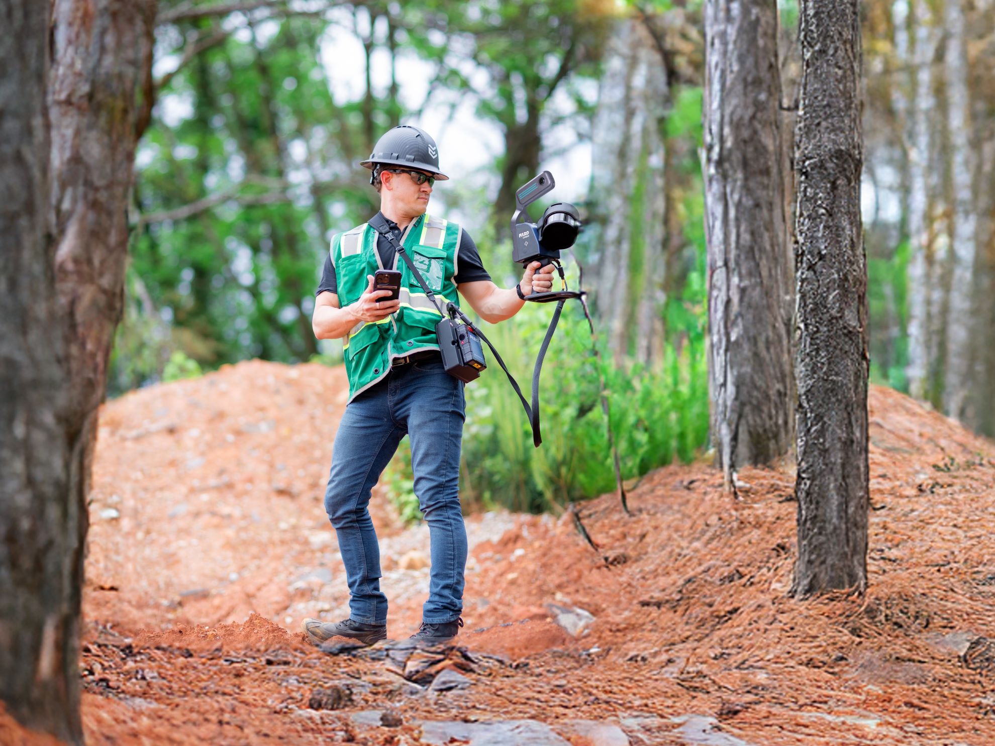
These impediments have created an opportunity to develop new technologies to assist in all construction phases. For example, SLAM technology or Simultaneous Localization and Mapping is a proven technology for fast data capture of existing facilities. SLAM works by mapping the moving scene using LIDAR (Light Detection and Ranging) and creating a digital 3D map of the space. It does not rely on GPS, so there is no need to remain static while scanning; it works indoors, outdoors, and together with drones or vehicle collection.

GeoSLAM is a leading developer of mobile capture technology. The accuracy of their ZEB Revo, and Horizon laser scanning sensors compare favorably to stationary measurements from static LiDAR-based instruments and exceed other SLAM-based mapping systems. Benefits of the GeoSLAM scanners include an easy-to-use, UAV-ready, modular design allowing for results to be checked right in the field while graphical UI and SLAM feedback reduce site time and create intelligent point clouds.
GeoSLAM achieves speed, simplicity, and quality both in the field and the office by following a straightforward Capture, Process, View, Create, Track/Communicate procedure.
GeoSLAM Connect, developed to complement GeoSLAM’s sensor technologies, allows for complete construction transparency and monitoring. In addition, this new application platform improves efficiency by creating accurate records for project lifecycle and future developments. Other functions include the following:
- Map and survey of restricted access sites
- Generation of automated construction progress reports
- Stockpile management with accurate volume mapping
- Creation of floor plans from ortho-accurate images or point cloud auto-vectorization
GeoSLAM Connect focuses on information, not just Data. Better communication and collaboration across all resources with real-time project evaluation improves productivity and saves money. Crucial site information is easily transferred to the office, enabling early clash detection to avoid delays and extraneous costs, and identifying potential workplace hazards. Additionally, GeoSLAM Connect software requires minimal training, making it an effortless addition to the project.

Combining GeoSLAM laser scanners and software applications results in a field capture time 10x faster than traditional laser scanning and survey techniques. Moreover, tracking progress against a 3D model or previous scan improves performance and decreases the impact of alterations on the project budget and schedule. In turn, avoiding any potential disputes and delay penalties.
GeoSLAM’s mobile capture technology allows for accurate as-constructed documentation of the building or industrial facility, eliminating inaccuracies from traditional field measurements or the reliance on outdated design drawings.
Tags: geoSLAM, LiDAR, MobileMapping, point3D, technology, ZEB
Categorized in: Articles
This post was written by Ross Semplice