Unlocking Next-Gen Reality Capture: FARO Introduces the Rovi i.1
Maintaining a clear understanding of site conditions is essential for keeping projects moving with confidence. Today, FARO takes a massive step forward in the evolution of digital twins with the launch of the Rovi i.1—a complete reality capture package designed to make everyday site documentation faster, easier, and more accessible.
What Is the Rovi i.1?
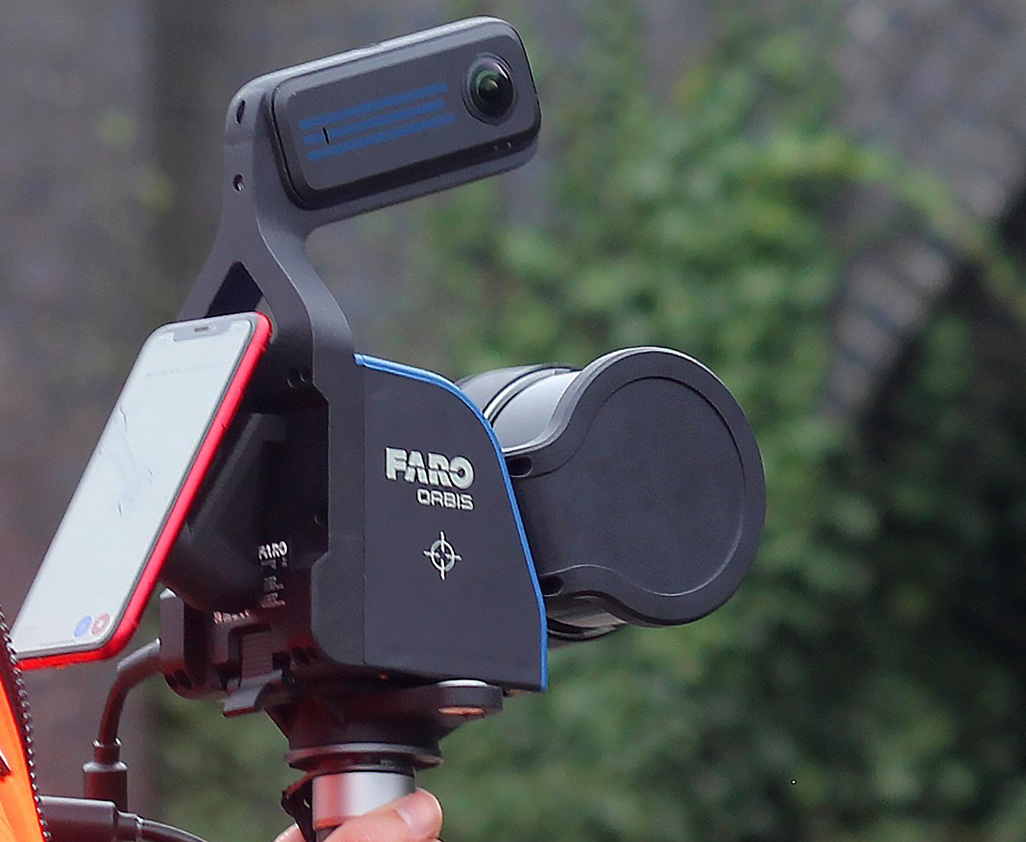
The Rovi i.1 is a highly portable, mobile walk-and-scan device that utilizes advanced Hybrid SLAM (Simultaneous Localization and Mapping) technology, combining both Visual and LiDAR sensors. Capable of generating point clouds at 200,000 points per second with an accuracy of $\le$1 cm, it allows users to capture current site conditions without requiring specialist reality capture expertise.
Crucially, the system features a magnetic phone holder that provides a real-time preview of the scan. This lets users verify site coverage while still on location, identifying missed areas immediately and eliminating the need for costly return visits.
Why It Was Developed: Cloud-Powered Collaboration
Historically, capturing and processing 3D site data required dedicated high-end workstations and graphics cards, often bottlenecking who could access the data. The Rovi i.1 is designed as part of a holistic workflow integrated natively with FARO Sphere® XG and SCENE.
Captured data is uploaded and processed in the cloud, generating deliverables your team already asks for—including floorplans, room measurements, volumetric analysis, and photorealistic 3D Gaussian splat (3DGS) models. By moving the heavy lifting to the cloud, any stakeholder can access, review, and collaborate on project information straight from a standard web browser.
Key Uses Across Industries
- AEC & BIM Verification: Align captured data directly against BIM to verify progress and identify issues earlier. By leveraging current site information, project teams can reduce rework, maintain visibility into project status, and make more informed decisions.
- Construction Monitoring: Turn every routine site visit into a measurable record. The ease of the walk-and-scan workflow means project managers can document daily progress effortlessly, delivering stunning 3DGS visual models to remote stakeholders.
- Geospatial & Scalable Workflows: Buy what the work needs. While the base unit supports everyday reality capture, an optional accessory kit—including an RTK/GNSS unit for georeferencing and a HighRes PanoCam—allows teams to position reality capture information within real-world coordinates and navigate via 360° imagery.
The FARO Rovi i.1 removes the traditional barriers to entry for high-quality 3D reality capture, ensuring your team has the reliable project insights needed to support informed decision-making.
To schedule a demo or discuss how the Rovi i.1 fits into your workflow, contact point3D today.