Project Planning for Public Spaces – Jackson Square
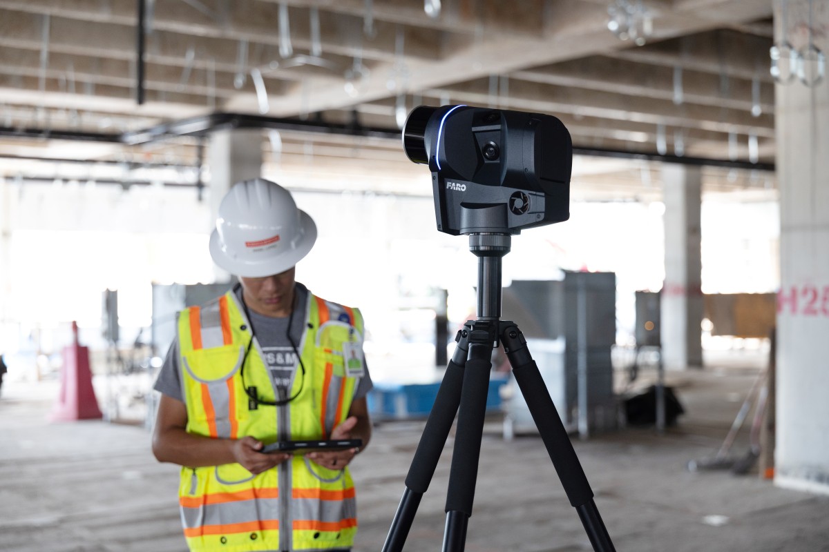
point3D was recently in New Orleans visiting clients. While there, we took a little time off to do some sightseeing, stopping by Jackson Square in the heart of the French Quarter. Of course, we didn’t go empty-handed. While regular tourists wander around with their phones and fancy cameras, the point3D team whipped out our GeoSLAM Horizon with vision camera to capture the scene in full-color 3D detail.
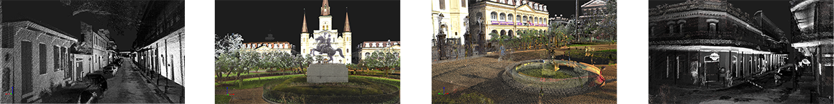
Jackson Square is an instantly recognizable landmark, getting its name from the large bronze statue of Andrew Jackson on his horse located at its center. The 2.5-acre space in front of the St. Louis Cathedral, the oldest Catholic Cathedral in the USA, hosts many of the city’s events and celebrations. It has even been used as a backdrop in several popular feature films and television shows.
Our purpose for scanning Jackson Square is to demonstrate the advancement of SLAM data capture and processing capabilities. Ideal for the maintenance and renovation management of public spaces, this technology is also an excellent solution for traffic management studies for vehicles and people – a necessity when working on notable landmarks. Additionally, the video shows how these modern-day solutions are viable for community impact studies and tourism.
The point3D team quickly captured the scene using the GeoSLAM ZEB Horizon handheld scanner fitted with the new vision camera, which takes 3600 panoramic images in 4K resolution. The colorized data was then registered and processed through the newly released GeoSLAM Connect 2.1.1 software. Connects improved filtering and workflow automation made removal of unwanted noise (tourists) a breeze. Next, we merged our completed point cloud data with data previously captured by SJB Group using terrestrial and mobile LiDar scanning equipment. Finally, the combined point cloud data was transferred to NUBIGON to create a fly-through of the park and surrounding area.
The stunningly detailed results include embedded panoramics for a side-by-side comparison of the point cloud data to the real-life site
Find out more about point3Ds technology offerings and how we can customize them to your project needs by contacting our knowledgable team at sales@point3D.com
Technology: Data captured with FARO Focus S350, Mobile LiDar, and GeoSLAM Horizon. Data processed in GeoSLAM Connect 2.1.1 and NUBIGON. Check out our Software Solutions page on LinkedIn for the latest software updates: https://www.linkedin.com/showcase/point3d-software
Tags: Flythrough, geoSLAM, MobileMapping, point3D, project_planning, realitycapture, visualization
Categorized in: Articles
This post was written by Gregory Lawes
1 Comment
Very interesting. Having been to NoLo many times, it was exciting to see the Square come to life with this technology.